What’s in a Name? Nantwich Streets Explored: Monk’s Lane
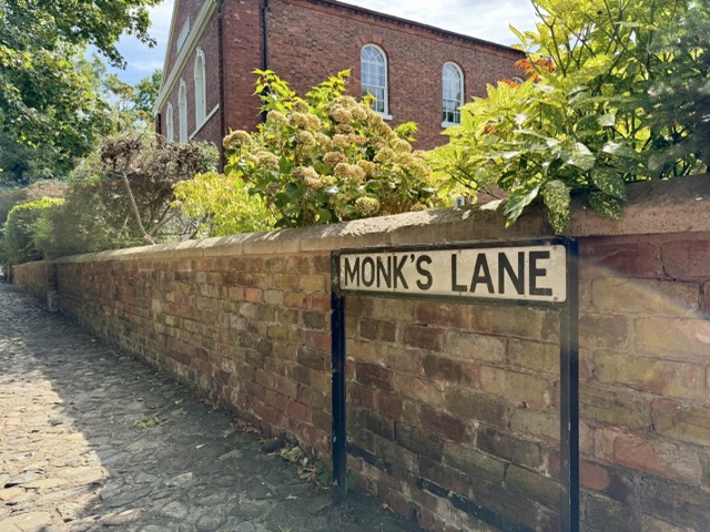
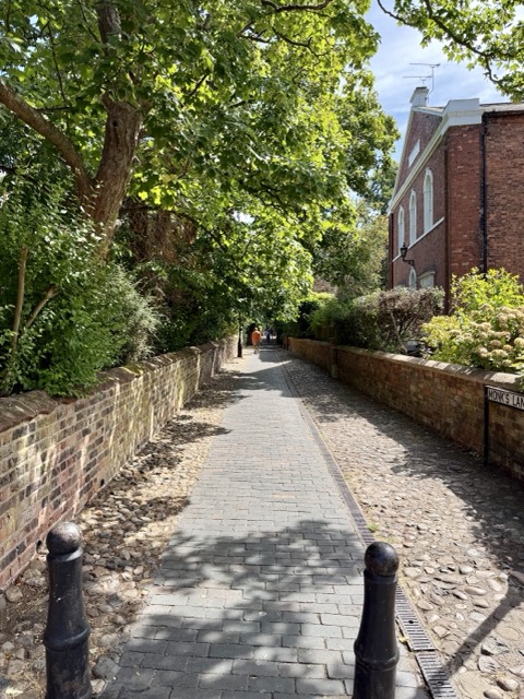
This leafy lane, with its impressive terrace of Georgian townhouses, cobbles and peaceful atmosphere is set in stark contrast to the hustle and bustle of the nearby town centre. Whilst Monk’s Lane sits firmly within the fabric of the centre of Nantwich, its origin story begins almost nine hundred years ago and six miles to the southwest.
Our story begins with the Norman conquest of England and the new lords of Nantwich, or as it was known then ‘Wich Malbank’. William Malbank was the first Baron of Wich Malbank. He made Nantwich the principal town of his barony, if you could call it a town at all. At this time Nantwich was mainly industrial in nature. The brine springs had been exploited on and off since Roman times but it was the construction of the Malbank seat of power at Nantwich Castle which marked the start of the towns development. He was also responsible for the founding of several religious institutions in the area including the Hospital of St. Nicholas around 1083-84 and is also said to have built a chapel, perhaps replacing an earlier Saxon chapel (but this is not known), a precursor to St. Mary’s church that we enjoy today.
It was his son, Hugh Malbank, who in 1133 following his fathers example, founded an Abbey at Combermere (about 6 miles to the south west of Nantwich) and granted to the order of monks large tracts of land and other rights, the income from which would ensure its success. He also gave them the chapel at Nantwich and its mother church at Acton.
And I also grant unto the same monks, the fourth part of the town of Wich and the tithe of my salt, and of the salt-pits that are mine, and (of those) that belong to others, and of my money, and the salt’ of the Blessed Virgin, and salt on Friday, and salt for the abbot’s table as freely as I have at my board.
– Quote from the foundation charter of Combermere Abbey (date unknown) recoded in James Hall’s ‘A history of the town and parish of Nantwich, or Wich-Malbank, in the county palatine of Chester’, 1883.
The land and other rights which were granted to the monks was known as ‘The Abbot’s Fee’ and in Nantwich this included parcels centred around modern day Monk’s Lane and the chapel. Despite giving the name to Monk’s lane, it’s likely that the Abbot’s Fee was mainly an economic and administrative endeavour. It appears that the houses, salt houses, fields and gardens which it owned were rented out to the townspeople to provide an income for the Abbey rather than the monks working the land and salt houses themselves.
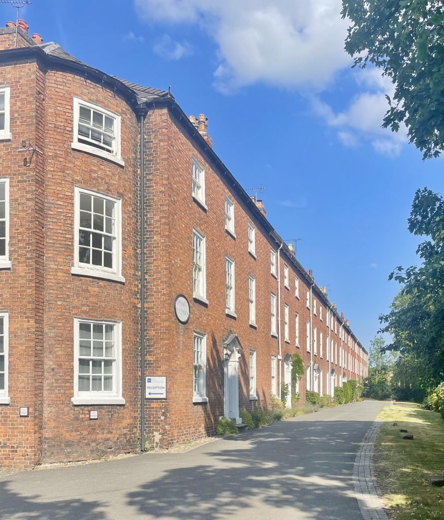
After the dissolution of the Abbey around 1538, its holdings passed through various owners eventually being acquired through marriage by the Tollemache family, the Earls of Dysart who gave their name to Dysart Buildings, the grand Georgian terrace which they built here in 1778-9.
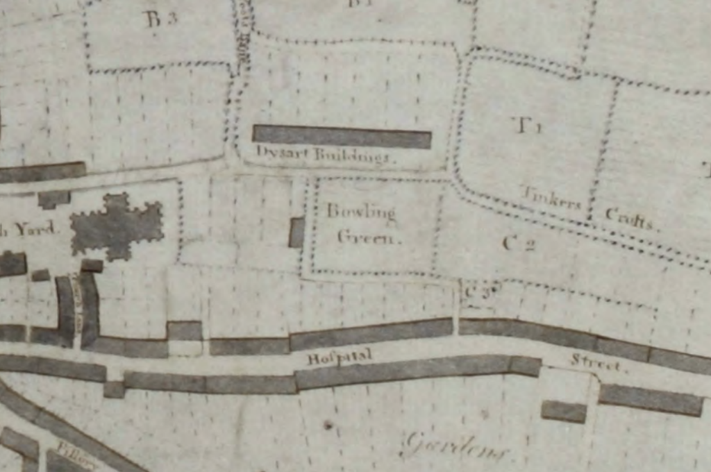
On the other side of the lane there was bowling green as shown on this map of Nantwich from 1798 on land which was originally a farm owned by the Abbey. ‘Tinkers Crofts’ is also shown on the map and formed part of the Abbot’s Fee. When this area was developed into housing the resulting streets were named North and South Crofts to maintain this link to its history.
The Monk’s Lane area as shown on The Board of Health Map of 1851:
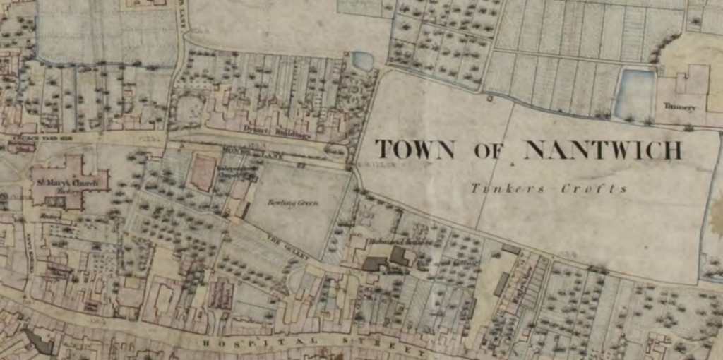
Also on this side of the lane is the former Congregational Chapel which moved here from their previous site on Church Lane in 1842. The chapel has now been converted to private homes.
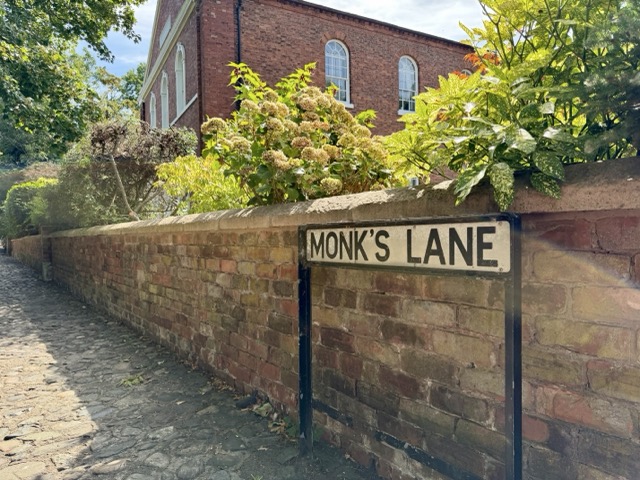
According to J. Dodgson in his book ‘The Place-names of Cheshire (1970) the earliest recorded mention of Monk’s Lane (Monkyslone) was in 1466, however, the name persists today despite the monks influence on this part of Nantwich ending almost 500 years ago.
Read more about Nantwich Street names here.
Bibliography
Bernie Strawson, 2022. -The Making of Nantwich in Six Maps. Nantwich Museum.
Jane Stevenson – Nantwich, A Brief History & Guide. Nantwich Museum.
Andrew Lamberton & Robin Gray, 2005. Lost Houses in Nantwich.
James Hall, 1883 – A history of the town and parish of Nantwich, or Wich-Malbank, in the county palatine of Chester.
J. Dodgson, 1970 – The Place-names of Cheshire.
https://historicengland.org.uk/listing/the-list/list-entry/1249422?section=overview